
Version 1.14 is out
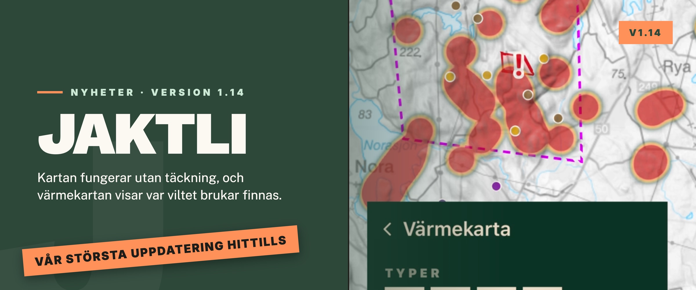
We have released version 1.14 of Jaktli. This version is about making the app work where the hunting happens: far out on the ground, often with no reception. The map can be downloaded in advance, and observations and markers are saved on the phone and sent on their own once the signal comes back. There is also a heat map that shows where the game tends to move, and the chat has gained replies, reactions and video.
The map without reception
Many hunting grounds sit where the phone has no coverage. Now you can download the map of your ground in advance. Tap the layers button at the bottom left of the map, then the download arrow next to the map style you use, and confirm. The map is saved on your phone and stays there until you remove it. If the team has several grounds, each is downloaded on its own, so the empty land in between takes no room.
The aerial imagery is downloaded the same way, but separately. The photos take a lot of space, often several hundred megabytes, so do it at home on wifi. If the download is interrupted it carries on from where it stopped the next time you tap.
Besides the map imagery, the app now also keeps the team's own information on the phone: markers, areas, lines, labels, observations, the calendar, tasks and contacts. Open the app without reception and you see the same map as last time, with everything the team has drawn. It used to show an empty map at times, or claim you had no team. How it all works is in the user guide.
Observations send themselves
See an animal, find a track, or want to place a new stand? Fill in the form and tap Save. The form closes at once, and the observation shows on your map right away. The app sends it, and the photo, in the background as soon as there is coverage, and retries on its own if it fails. While something is waiting, a small box at the top of the map says what is left, for example "2 observations left to send". If it will not go through at all you can tap Try again. Nothing is lost. Everything stays on the phone until it has been sent.
The same goes for markers you add to the map. The rest of the team sees the observation or marker once it has been sent.
The app also no longer signs you out just because the signal dropped. That used to happen now and then when the phone lost reception in the middle of a hunt, leaving you at the login screen when you needed the map most. Now you are only signed out when the server actually says the session has ended.
Heat map: see where the game tends to be
The heat map lays all the team's observations over the map at once, both from hunts and those added on the map. Where many observations sit close together the map turns warm, from green through yellow to red. That shows you where the moose usually pass, or where the boar keep to in autumn.
Turn on Heatmap in the layers menu. In its settings you choose which types count, whether each observation or each animal is counted, which period applies, and a single species if you like. Turn on Time of year and drag the slider at the bottom to see how the game moves through the year. Tap play and it runs by itself. Available on both mobile and web. Read more in the user guide.
Where did the animal go, and how did it react?
When you add an observation you can now show where the animal came from and where it went. Tap Came from and point on the map, then Went towards and point again. The line is drawn on the map as you point, with an arrow in the direction the animal went, and the form shows bearing and distance.
For wounded game you can also record the shot reaction, that is how the animal reacted to the shot: a high leap, a hunched back, running on three legs, no visible reaction and so on. Together with the flight direction that is exactly what the tracking-dog handler wants to know. All of it is optional.
The observation form is shorter too, you can remove a photo again, and the map stays where you had it when you are done.
Texts, tracks and your position
Texts on the map can now have several lines and a colour of their own, and they are fixed to the ground: zoom out and the text gets smaller, zoom in and it grows. Good for a name across a whole section of ground. The text is drawn on the map as you type, so you see how big it will be.
Record a track. Walk the path you want to draw, say a trail or a shooting lane, and the phone draws the line for you. Tap + and pick Record track. The line is drawn as you walk. Tap Stop when you arrive, give it a name and save, and it sits on the team map like any other line.
Share your position outside a hunt. Want the team to see where you are even when no hunt is running, say when you sit on a stand alone or set up bait? Tap the arrow button above Start hunt on the map and turn on sharing in the box that opens. The team sees your latest position, no trail. Sharing carries on in the background until you turn it off, and if you start a hunt the hunt takes over. Read more in the user guide.
The chat
The chat has gained most of what was missing.
- Reply to a message. Tap the arrow next to the message, or drag it to the right in the app. The quoted message shows above your reply.
- React with a symbol. Tap the small face next to a message. Besides the usual symbols there are Jaktli's own animals: moose, roe deer, wild boar, red deer and more. Tap a symbol someone else picked to pick the same, and hold your finger on it to see who reacted. An easy way to see who has read "Meet at 07:00".
- Type a symbol in the message. Type a colon and the start of the word,
for example
:fox, and you get suggestions. Type:moose:and the moose is inserted by itself. - Files and video. Attach PDF, Word, Excel, GPX, KML and other files, or a video. In the app you can pick a video from the photo library or record one on the spot, and it plays in the chat.
- Links in messages can be tapped.
It is all in the user guide.
Markers and the map
The form for a new marker has been rebuilt. The types sit in groups, labels are picked from a searchable list, the description is folded away until you need it, and the coordinates can be typed in by hand if you have them from a GPS. A camera marker is now picked from the team's trail cameras, and the marker takes the camera's name by itself.
The pins on the map stand on their tip, all the same size, and are easier to hit with a finger. Zoom far out and markers, areas and lines gather into a cluster with a count, so the map does not turn into a blur. If you would rather see everything, turn it off under Filter. The label filter is folded away until you open it. The compass is always visible, the wind has a tile of its own next to it, and neither jumps any more when a hunt starts or ends.
Dog trails now drop the points a collar sends when it wakes up and reports the place where it was switched off, and other impossible jumps.
Trail cameras
The Trail cameras page now has two views. By camera shows one row per camera as before, and there the Sort button now sets the order of the cameras: recently added, latest photo or name. All photos shows the photos from every camera together, newest first, with the camera's name on each photo, and when you open a photo you browse on through all of them. Your choice is kept for next time.
The full-screen viewer in the app, for trail cameras and the gallery alike, now turns with the phone, has a dark backdrop and hides the buttons when you tap the photo.
On the web
Printing the map has improved. You can download it as a PDF, the format a print shop prefers, choose hillshading, set the size of markers, lines and text with sliders, and see the paper size in centimetres along the edge. The print can be made without a frame, and the file is named with the title, date, paper size and resolution. The web home page has a tighter grid with every part of the app.
Other changes
- Forms in the app are now only as tall as they need to be, with Cancel on the left and Save at the top right. Save is always in reach, however far you have scrolled.
- Deleted the team by mistake? The team disappears at once, but its data is kept for 30 days. Get in touch within that time and we put it back.
- Feedback can now carry up to five screenshots, and can be sent even if you are not in a team.
- All the team's receipts are now listed under Billing, so they can be downloaded again. Teams that pay a year at a time by Swish show as active, with the date they are paid until.
- The app now launches as it should on iPhones with iOS 27. A crash on Android when a page closed is fixed.
- Dog tracking: Jaktli OpenTrack is now out as a beta for iPhone, and the Garmin guide shows pictures of the watch and the handheld.
Get in touch if anything misbehaves. We read all feedback.